
Eco-path "A time trail through the ages" above Buzovgrad
- Stefan Ivanov

- Jun 10, 2023
- 18 min read
Updated: Jan 20, 2025
Dear friends of "Photo Moments", I present to you another spectacular adventure, including unique photo moments and videos, perfect mood, many smiles, hot sun, fluffy white clouds and vast and impressive views of the entire Rose Valley and the Valley of the Thracian Kings, the proud and old Balkan, Koprinka Dam and the submerged Thracian capital city of Sevtopolis, Freedom Monument, the village of Buzovgrad and the city of Kazanlak!
I present to you the eco-path "A time trail through the ages"!

This publication contains detailed and detailed information about the entire route, as well as beautiful and informative photo moments and videos. The purpose of the publication is to make it as easy as possible for each of you when you decide to make the transition in the field.
General information
Starting point: Buzovgrad village, Kazanlak municipality, Stara Zagora region.
Type of eco-path: circular (Buzovgrad – Dyadopenova Chesma – Megalith – Fortress "Buzovo Kale" – Cherkovishta – Thracian mound – Buzovgrad).
Total length: about 6 kilometers (entirely pedestrian section)
Duration: about 2 hours. Keep in mind the difference in elevation and the amazing views from the viewing platforms, which will significantly increase the total time to at least 4 hours (minimum).
Appropriate equipment: comfortable and tall hiking shoes, as well as comfortable clothing and outerwear according to the season.
Difficulty of the route: the path, given the unevenness for the most part, is medium easy, shaded in most places, without particular difficulties and requiring attention in places.
Elevation:
at the starting point: 363 meters above sea level
at Men's stone point: 490 meters above sea level
at Megalith natural landmark point: 543 meters above sea level
at Dyalani kamak point: 551 meters above sea level
at the fortress point "Buzovo Kale": 514 meters above sea level up to 501 meters above sea level
at Cherkovishta point: 492 meters above sea level
at Thracian mound point: 394 meters above sea level
at the final point of the eco-path (near the cemetery at the end of the village of Buzovgrad): 372 meters above sea level.
Main sites along the eco-trail:
The man's stone
Grandfather's fountain
Natural landmark Megalith
The split stone
Runway for hang gliders
Buzovo Kale Fortress
Panoramic sites
Church
Thracian mound

How to get to the village of Buzovgrad?
The village of Buzovgrad is located 5 kilometers south of the town of Kazanlak.
Buzovgrad stands on:
240 kilometers (about 3 hours by car) from the capital
108 kilometers (about 1 hour and 45 minutes by car) from the city of Plovdiv
294 kilometers (about 3 hours and 55 minutes by car) from the city of Varna
192 kilometers (about 2 hours by car) from the city of Burgas
The village is located in the middle of the charmingly beautiful northern slopes of Sarnena Sredna Gora near the right bank of the Tundzha River.
Until 1906, the village was called Armaganovo.
Entering the village of Buzovgrad from the town of Kazanlak, continue straight until you see the sign for the end of the village, as I have marked on the Google StreetView image below.

There is a sign on the power pole to the right. Take the street indicated by the red arrow.
On the map this fork looks like this:
This is the starting point of the "A time trail through the ages" eco-trail.

I parked my car by the river.
The following information boards are located at the beginning of the eco-path:


As can be seen from the photo moment, the marking of the path (in this part of it) is white - green - white.
The estimated time to reach the Megalith natural landmark is about 50 minutes, not counting the breaks along the trail.
Anyone interested can call the indicated phones in advance to receive their map of the area:
Buzovgrad City Hall: 0431 9 82 29
Tourist Association "Eagle's Nest" city of Kazanlak: 0431 6 25 66
I remind once again about the trail markings - white - green - white! Follow the marking colors and you'll be fine!


And this is where my story begins - my adventure along the "A time trail through the ages" eco-trail.
I take the path, leaving the village, and already find myself in the embrace of the forest.

The path to Megalith is mostly rocky. My advice is to take your time and be careful!


Undoubtedly, every season is majestically beautiful here! But along the path in the spring, amazing beauties bloom, which literally steal from the total time of walking, because I kept trying to seal the perfect photo moment.
In places along the path there are benches, which are located under the shadows of the centuries-old trees around and in the silence of the Sarnena Sredna gora, broken only by the song of the birds.
Slowly I arrive at the first fork leading to the Men's Stone.

Here at the first fork, it's time to share something very important with you!
You can continue from here in the direction of the natural landmark Megalith, taking the path leading to the Men's Stone, i.e. that way you'll see both megaliths without wasting time returning to that position!
Important!
The path leading to the Men's Stone continues in the direction of the natural landmark Megalith!
The only thing you will miss if you go from this point in the direction of the Men's Stone is the grandfather fountain, because the eco-path is circular!
Due to the lack of time, I chose this route, which passes through the grandfather's fountain, and did not stop to see and photograph the Men's Stone.

The time to reach Grandfather Penyo's Fountain (from the starting point) is about 45 minutes.
A gazebo with wooden benches and a table has been built here, where you can sit, eat and drink - just relax.
The fountain has two spouts and was built in 1933, as can be seen from the inscription on it.
After 10 minutes of walking, the completely shaded path brings me to a large sunny spot with another gazebo and a few tables and benches around.
From this place it can be taken in three different directions.


One of the possible directions is the Men's Stone site, located about 12 minutes away.
If you had taken the previous fork, you would have exited right here.

The second branch is for the natural landmark Megalith, located 5 minutes away.

The third option is in the direction of the Divided stone and Buzovo Kale fortress.

I went to the natural landmark Megalith - a place from which a magnificent panoramic view is revealed!
Natural landmark Megalith
The path takes me to the megalith in about 5 minutes.

Nearby there are built wooden benches where you can rest.

A natural landmark Megalith is an object from the third millennium BC.
In the above photo moment, I have shown the place from where the sun is visible during the summer solstice.
I'm sharing with you something that made a big impression on me!
In addition to the fact that the sun sets at this point on June 21 - during the summer solstice (the longest day of the year), through the shaped opening between the rocks you can see the outline of the Koprinka Dam and the exact place where today the ancient Thracian city is submerged - capital Sevtopolis*.
*Seutopolis is an ancient city founded by the Thracian king Seutus III, the capital of the Odris kingdom from 320 BC.
The ruins of Sevtopolis were discovered in 1948 during the construction of the "Georgi Dimitrov" dam (now called "Koprinka"). The team of Bulgarian archaeologists under the leadership of Prof. Dimitar P. Dimitrov, who excavated the city, established the name and worked on the remains of the Thracian city. Nevertheless, it was decided to proceed with the construction of the dam and Seutopolis was submerged.
The archaeological study of the ruins of the ancient city lasted seven years - from 1948 to 1955. Within this time period, all the ruins of the ancient Thracian city and three large mounds from its necropolis were explored.
Seutopolis was located on the left bank of the Tonzos River (today's Tunja), on a small peninsula with a flat surface, slightly sloping south to the river. Naturally protected on three sides by the waters of the river, the city was strongly fortified with fortress walls, the stone foundations of which were revealed during the survey. The fortress, which followed the outline of the peninsula, has the shape of a versatile pentagon. The fortified part of the city covered about 50 acres and was almost completely excavated during the survey. The total circumference of the fortress wall was 890 meters.
In 2005, the Bulgarian architect Zheko Tilev proposed a project for the discovery, preservation and restoration of the city of Sevtopolis (the best preserved Thracian city in Bulgaria) using dam walls around the ruins in the middle of the dam. Thus, Sevtopolis could be included by UNESCO in the list of world cultural heritage and would become a tourist destination of world importance. The project was donated by the architect of the municipality of Kazanlak and the collection of funds to start construction began. According to Tilev, it will have a minimum price of €50 million.

I found this coincidence somewhat strange.
Be careful when ducking between the rocks!
After the adventure I talked to the locals who shared about the incredible crowds of people who come here on this very date on the first day of summer. That is why it is probably better to choose another day to visit this magical and unique place.
The view
For some, the rock phenomenon is interesting, for others – its history, purpose or way of creation, I, I confess, came for the view!

I'm here because of the amazing, impressive, fascinating, wondrous, delightful, overwhelming, dazzling... (are you getting enough epithets?) (almost) 360 degree view from the cliffs! This has to be experienced – whatever I share will be little!
I captured all this in a wonderful film and now I present it to you! Enjoy watching!
The time I spent in photos and contemplation was about an hour and a half... and it was enough for me!
From the place there is a view of:
Rose Valley
Valley of the Thracian Kings
Buzovgrad village
The city of Kazanlak
Koprinka Dam (and the city of Sevtopolis under the water)
Koprinka village
Stara planina
Mount Botev
Freedom Monument (Shipka)
Buzludzha
The wind turbines on the ridge of the Balkans
The golden cubes of the Nativity of Christ memorial church
City of Shipka
Sheynovo village
Hadji Dimitrovo village
Gorno Cherkovishte village
I'm probably missing something, but the view is amazing!
From the natural landmark Megalith I return to the starting position at the gazebo with the benches and the information boards.
In case, like me, you missed the Man Stone, now is the time to take (probably about) twenty minutes to check it out. Remember, you have to come back here again to walk the whole trail!
The route leads me to the next site - the Divided Stone.

The path leads me to a fork, from where it goes in two directions - to the "Buzovo Kale" fortress and to the Divided stone.
Divided stone
The Divided stone is located to the right of the wide road about 5 minutes after the fork shown in the above photo moment, so be careful not to miss it!

A split stone is a huge chunk of rock laid on the ground that has been perfectly smoothed, apparently by human intervention.
I take a picture of it and go back to the fork with the information sign-arrows to take the path to the "Buzovo Kale" fortress.
Several objects can be seen along the path leading to the "Buzovo Kale" fortress:
Panoramic platforms, from which a wonderful view is also revealed
A panoramic platform for hang-gliders.
Trail markings are now white-blue-white.


Buzovo Kale Fortress
The late antique and medieval fortress "Buzovo Kale" was built on the steep slopes of the northern elevation of Sarnena Sredna Gora.
The place was not chosen by chance, because the height is crowned with numerous high and impenetrable rock groups, which are extremely skillfully included in the defense line of the fortress.
The easiest access to the top of the height is from the southwest, through a narrow saddle that separates it from the neighboring massif.

"Buzovo Kale" fortress occupies a leveled ridge formed between separate rock groups. It has an irregular polygonal shape, fully adapted to the terrain on which it was erected.

The maximum dimensions of the site are 103 meters by 46 meters and it occupies an area of 3.7 acres.
The fortification was equipped with a double fortress wall on the accessible southwest side and probably a citadel in the northeast corner.
The fortress walls were built in the opus emplectum style of well-arranged medium-sized rubble stones and a block between them of smaller stones, liberally jointed with white mortar mixed with broken brick.
The curtains* are 1.95 to 2.20 meters thick and are preserved today up to 4 meters high.
*Curtain is a term derived from the French word courtine, which in the Middle Ages meant a theater curtain hanging between two columns. The term later entered historical literature in descriptions of ancient and later defensive structures, so that the term now refers to any rampart or rampart located between two flanking structures.
The length of the curtain, i.e. the distance between the bastions, as a rule, is determined by the firing range of bows, crossbows, rifles, muskets and light artillery - weapons used by the defenders in the era when the fortress was built.
However, over time, the distance between the bastions, despite the increase in the firing range, became smaller and smaller.
The two fortress walls, built from the southwest of the fortress, stand two meters apart from each other.
It is assumed that the inner wall was higher than the outer, but so far no steps have been found to climb the curtains, so that it is possible to conclude exactly how high the battlements rose.

An interesting element in the construction of the defense of the "Buzovo Kale" fortress is the inclusion of large rock groups within the fortress walls, crossing the fortress lines in several places. The rocks were used as buttresses to support the curtains and as a supporting element of the fortress towers.

The southwestern section of the fort is located on the highest point of the hill. At this point today we observe one of the two fortress battle towers established up to that point. The ruins of the south-western battle fortress tower, shown in the above photo, are central, and the entire defense of the fortress in this section is built around it. It rises above the saddle and is built on and around one of the rocks on the rise. The shape of the battle tower is irregular, measuring 6 by 8 meters, and the rock base, besides raising it to a much greater height, makes it massive and impossible to undermine.
Currently, the ruins that I observe - the remains of this ancient structure are preserved at a height of 3 meters.

It is from this tower that the two fortress walls of the "Buzovo Kale" fortress separate.
After the tower, the inner wall turns sharply to the northeast, and its course can be traced with a glance along the edge of the crown of the hill.

The outer wall continues in a northwesterly direction. At the moment, the end of this wall has not been established, but the idea of continuing the route in this direction is clear. This prevents the unhindered passage of enemy troops who would try to bypass the saddle and climb the slope, attacking the stronghold from the northwest.

Attacking the northwestern wall of the "Buzovo Kale" fortress from the foot of the hill is difficult due to the extremely steep slope, but there is a possibility of bypassing the saddle from the northwest, with the enemy going down the northern higher slope of the ridge in front of the fortress. It is for this reason that the route of the outer fortress wall was drawn further to the northwest, so as to cut off any possibility of bypassing the fortress.

A moat was dug through the saddle in front of the central fortress tower, which separates the hill. It has a V-shaped section, its outer side is vertical and 3 meters high, and the inner side, on the side of the fortress, is inclined.
Broken medieval pottery was found in the moat, which suggests that it was neglected by the 14th century.
Other fortification solutions can be observed in the south-eastern part of the fortress.
In this place the slope of the hill is much steeper and a double fortress wall, like the one in the south-west, was not necessary. In this section, the slopes and inside the "Buzovo Kale" fortress are quite steep, which allows for a staggered arrangement of the buildings. Here the fortress wall is 1.95 meters thick, and its construction style is similar to that of the other walls.
A fortress church measuring 12.9 x 6.3 meters was attached to the inside of this wall.
In the middle of the 6th century, during the large-scale construction undertaken by Emperor Justinian I, the church was extended to the north and acquired a vestibule from the west.
Near the ruins of the "Buzovo Kale" fortress, I shot my film, which I am happy to present to you! Enjoy watching!
From the "Buzovo Kale" fortress, I continue my route in the direction of Cherkovishta (means the Churches).

From here the path descends steeply and I urge your attention to be as vigilant as possible!
The churches
In no more than 10 minutes I arrive in front of the remains of the Churches - late antique Christian temples with a basic plan, built in the period from the 4th to the 6th century AD.
The temples were created to serve the population of the settlements at the foot of Sarnena Sredna Gora, as well as the garrison of the neighboring fortress - "Buzovo Kale".

The large late antique basilica discovered was built on level ground and is a one-nave, one-apse building measuring 20 by 8.3 meters. It was built of different sized, processed stones, joined with white mortar, mixed with crushed brick and large river ballast.
A wooden roof covered with tegulis was built on top of the basilica, and yellow plaster with decoration was laid on the outside.
The temple was burned down at the end of the 6th or the beginning of the 7th century, after which it ceased to exist.
A large suburb stretched around the basilica, which archaeologists assume was part of the "Buzovo Kale" fortress.


Directly in front of the basilica, there are these signposts and arrows, from which it becomes clear the next site - the Thracian tomb, located about 20 minutes away.

A minute after Cherkovishta (Churches), you come to another panoramic platform - huge pieces of rock, from which an impressive view is revealed.

The path is steeper in places and you have to be careful.

Here I am in front of the last object of today's yet another memorable and slightly tiring adventure – Thracian Tomb.
Thracian tomb
The site is currently sealed and closed.
The tomb near Buzovgrad was partly destroyed and looted in ancient times. It is probably then that its stately facade was destroyed, the doors of the chambers disappeared and the metal rings that held them were torn out and the lifting of the floor blocks began. The absence of any finds that could lead to a more precise dating do not allow the chronological framework of the construction and use of the site to be determined.

The Thracian tomb is dated to the end of the 4th century BC.
During the excavations, two ritual hearths and a number of ancient facilities were discovered.
One eshara (cult hearth), beautifully and richly decorated with spiral ornaments, is made of clay stucco with rich ornamentation. Below it was found a second - earlier one, an eschar, which is smaller and with poorer decoration. Around the two hearths there were buildings with a wooden structure, the walls of which were plastered with clay. Around them were found a large number of fragments of ceramic vessels, chromells, loom weights, deer antler cannons, etc. Due to their high artistic value, it was decided that the two eschars should be preserved and lifted from the field to be restored and prepared for display.
The materials found in the studied contexts in the southern periphery of the mound show that long after the burial, the closing of the tomb and the filling of the mound, acts of veneration of the Thracian aristocrat buried in the tomb continued.
The tomb is a typical representative of the domed tombs with a round chamber, a closed pre-burial chamber and a dromos, widespread in the Thracian lands, mainly south of Stara Planina.
Tombs of this type were also found in the Kazanlak basin. Some of them are built of bricks, such as Kazanlashka, but the majority are built of stone (granite) blocks - Golyama Arsenalka, Mogilata s grifonite, Shushmanets, Golyama Kosmatka, Ostrusha and Dolno Izvorovo.
From this site, the route continues to the left in front of the tomb!
The trail is narrow, unmarked and has many forks which is confusing. That is why I will give you the following advice - the village of Buzovgrad is already visible in the distance and just take the path leading in the direction of the village.
After about 15 minutes of brisk walking, you will pass the village cemetery and find yourself in the village.

At the finish you will see these rocks arranged to resemble a Megalith.

From here, look for the next street - "Mitko Palauzov" street, and just continue straight along it and you will be at your car in 10 minutes.
What can be visited nearby?
Only 5 kilometers (about 7 minutes by car) from the village of Buzovgrad is the town of Kazanlak.
In Kazanlak, you can visit the rose museum.

After viewing the museum's rich exposition, I suggest you take a relaxing walk through the wonderful alleys of Rosarium Park in the city of Kazanlak.

In the city of Kazanlak, I suggest you also visit the church "Saint Ilia", also known as the Kulenska church.

50 kilometers east of Buzovgrad (about 40 minutes by car) you will find the "Zhrebchevo" dam.
The ruins of the sunken church "St. Ivan Rilski" still stand by the dam.

26 kilometers west of Buzovgrad (about 24 minutes by car) you will find the town of Pavel Banya.

3 kilometers east of Pavel Banya (about 5 minutes by car) you will find the village of Viden.
The proud ruins of the wonderful church "St. Anastasius" still stand near the village.

4 kilometers south of Pavel Banya (about 7 minutes by car) is the village of Turia.
Here you can see the birthplace of Chudomir.

On the square in front of Chudomir's house, you can see a monument to the Chetnik Tsanko Minkov Dechev, born in Turia Botev - the Committee.

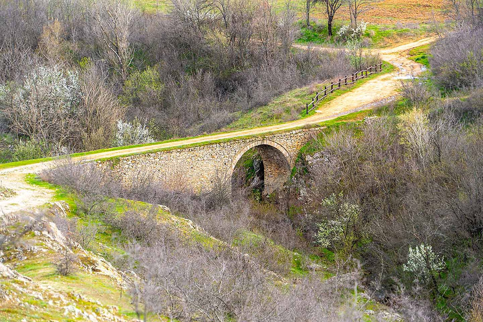
In Turia you can enjoy an authentic Roman bridge "Skoka".

At 8 kilometers from Turia (about 9 minutes by car) you can enjoy the natural landmark Hornbeam tree.

Quite close to Hornbeam tree you can see Kutela.

60 kilometers southwest of Buzovgrad (about 59 minutes by car) you will find the village of Babek. "Babek" dam is located nearby, near which you can take a wonderful walk.

Just 10 kilometers north of the village of Babek (about 16 minutes by car) you will find the Svezhen Architectural and Historical Reserve.
In the village of Svezhen, you can visit the church "Holy Apostles Peter and Paul".

You can visit the ruins of the old church "St. George", near which the foundations have been discovered - the remains of cells plastered with mud plaster on the walls, which are supposed to have been inhabited by the scribes-calligraphers of the Adjarian literary school.

70 kilometers southwest of Buzovgrad (about 1 hour and 13 minutes by car) is the town of Brezovo.
In Brezovo on a weekday, stop by the municipality to see the exhibition dedicated to Beethoven's best portraitist - Mincho Katsarov.

Another great Bulgarian artist - Zlatyo Boyadzhiev - is from Brezovo. His house in the town of Brezovo is open for visits and anyone can see it.

15 kilometers from the town of Brezovo (about 15 minutes by car) you will find the town of Rakovski.
In Rakovski, be sure to immerse yourself in the magic of Bulgarian folk tales by visiting the "Fairy Tale Forest" park.

Tales that the park will tell you:
An adapted playground is located nearby.

58 kilometers northwest of Buzovgrad (about 52 minutes by car) is the town of Karlovo.
In Karlovo, I recommend taking a walk to the Ethnographic Complex "Old Karlovo".


It includes five houses - monuments of culture with remarkable cultural value. These are:
Each of the houses gives rise to its own unique message, which directs the guest in different directions, provokes desires and memories in him, makes him dream.
The integrity of the architectural ensemble is unique and inimitable, and every visitor could feel that great revival spirit that still roams the narrow cobbled streets of "Old Karlovo".
Ethnographic complex "Old Karlovo" is site number 44b of the 100 national tourist sites.
In Karlovo, I recommend taking a walk to the beautiful Suchurum waterfall.

Only 5 kilometers west of the town of Karlovo (about 6 minutes by car) is the town of Sopot.
In Sopot, you must visit the "Ivan Vazov" house-museum.

In the city of Sopot, you can visit the charming Sopot waterfalls.

And as a finale, my dear friends,
you shouldn't miss a look
the special album with photo moments –
discovered, experienced, captured and shared with you!


Comments