
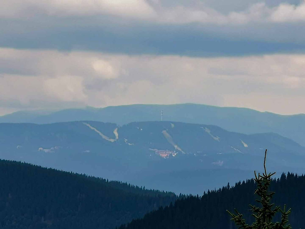
"Snezhanka" television tower, rising on Snezhanka Peak - the highest in the Pamporovo ski resort area and Bukova Mountain ridge in the Western Rhodopes
- Stefan Ivanov

- Apr 1, 2025
- 10 min read
I find myself in the middle of the beating green heart of one of the most beautiful Bulgarian mountains.

It is known by many names – Slaveevi Gori, Dospat, Rhodope Mountain, Rhodope Mountains.

Amazed, delighted, curious and happy, I drive along Republican Road II-86, winding through the valley of the Chepelar River.

Just before the Rozhen saddle, I turn south at the junction for the Pamporovo ski resort.

My path takes me back to my favorite place, rising to the highest peak in the Pamporovo ski resort area and Bukova Mountain* in the Western Rhodopes.

*Bukova Mountain is a mountain ridge in the central parts of the Western Rhodopes, a southern branch of the Perelik-Prespa division, located on the territory of the Smolyan district.

The ridge extends from north to south for about 12 kilometers, and its width reaches 8 kilometers. To the west, the high Prevala saddle (Eshekulak peak, 1687.5 meters) connects it with the Perelik division, to the northeast the Rozhen saddle (1439 meters) - with the Prespa division, and to the north the Pamporovo saddle (1576 meters) - with the Chernatitsa ridge.

To the south it extends to the valley of the Cherna River (a left tributary of the Arda), which separates it from Kainadine Ridge, and to the east it descends steeply to the valley of the Byala River (a left tributary of the Cherna).

The ridge's summits rise to about 1800 meters, with its highest point, Snezhanka Peak, with a height of 1925.8 meters, located in its northernmost part, within the boundaries of Pamporovo - one of the largest and most visited ski resorts in Bulgaria.

Snezhanka Peak is located in the heart of the Rhodope Mountains. Its almost 1926 meters rank it in 11th place in height in the vast Slavey Mountains.

On Snezhanka rises the slender and elegant silhouette of a tall television tower. Its name is also Snezhanka. From its top, a wonderful panorama opens in all directions!
I'm headed to "Snezhanka" once again! I'm once again feeling the urge to climb the tower, to step out onto the phenomenal 360-degree terrace, to enjoy the majestic and unique panorama and to fall in love with my Bulgaria even more!
But everything in its own way.

The television tower on Snezhanka Peak is one of the symbols of Pamporovo and the Rhodope Mountains.

It is visible from afar and somehow definitely distinguishes the peak.

It was designed in the 1970s by a team skillfully led by engineer Ivan Yantahov.

Its construction started in 1973 and was completed 5 years later - in 1978.

The height of the Snezhanka TV tower is 156 meters. The base of the tower is located at an altitude of just over 2000 meters. Thus, the highest point of Snezhanka rises to an impressive 2082 meters above sea level.
The different floors of the tower are reached by elevators.

In its upper part, the tower has two huge rings.
The lower ring houses specialized communication equipment for transmitting radio and television signals, providing coverage in the Rhodope Mountains region.

The upper ring, which rises 93 meters above the base, houses a 360-degree panorama cafe located at an altitude of 2,019 meters, which leads to an open 360-degree panoramic terrace.


The view from the terrace towards the infinity and vastness of the Rhodope Ocean deeply amazes every heart and makes it beat faster in the chest!

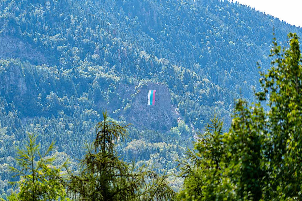
To the northeast, a magnificent panorama opens in the direction of the National Astronomical Observatory "Rozhen", to the vast Rozhen meadows, located at 1430 meters above sea level. In the middle of the meadows rises the highest pylon in Bulgaria, 111 meters high, on which the Bulgarian tricolor flutters.

Looking southwest, one can see the peak of the Rhodope Mountains – Golyam Perelik Peak with its 2,191 meters.

Looking northwest, we see Golyam Persenk Peak with its 2,091 meters, and to the south, on clear days, we can even see the Aegean Sea.

When strong winds blow, the top of the tower deviates up to a meter and a half from the base, and in hurricane winds you can even see it sway.

Most of the slopes in the area start from the top, including one of the steepest - The Wall, which is recommended only for advanced skiers. In winter, in addition to skiing and snowboarding, you can practice winter fishing and snowmobiling.
A number of routes for mountain bike enthusiasts also start from the top.
The Snezhanka TV Tower is site number 83 of the 100 national tourist sites.
Snezhanka Peak is site number 84a of the 100 national tourist sites.
In the southern part of the foot of the peak is the starting point of the trail leading to Orpheus Rocks, which offers a fantastic view of the Smolyan Lakes.

Dear friends, I introduced you to the Snezhanka TV tower, rising on Snezhanka Peak - the highest in the Pamporovo ski resort area and Bukova Mountain in the Western Rhodopes. Now I will inform you how it is possible to get here in any season.
How to get to the city of Smolyan?
Smolyan is a city in Southern Bulgaria, located in the Perelik-Prespa section of the Western Rhodopes at a high average altitude of 1035 meters, making it the highest located regional city in Bulgaria.

It is located about ten kilometers from one of the largest winter resorts in Bulgaria - Pamporovo and Mechi Chal.
The city was formed on June 18, 1960 as a result of the unification of the cities of Smolyan and Ustovo, as well as the villages of Raykovo and Ezerovo.
It is the administrative center of Smolyan Municipality and Smolyan District.

Smolyan is also one of the longest cities in Bulgaria - nearly 25 kilometers, which is due to its linear development along the Cherna and Byala rivers.

Smolyan is located:
244 kilometers (about 3 hours and 36 minutes by car) from the capital
98 kilometers (about 2 hours and 03 minutes by car) from the city of Plovdiv
428 kilometers (about 5 hours and 56 minutes by car) from the city of Varna
321 kilometers (about 4 hours and 04 minutes by car) from the city of Burgas
How do you get to Snezhanka Peak?
Depending on the season, there are different ways to reach Snezhanka Peak. The safest are the four lifts:
Studenets – Snezhanka
Smolyanski Ezera – Snezhanka
Malina – Snezhanka
Stoykite – Snezhanka.
In winter, there is hardly any other way to reach the peak, unless you are a fan of winter hikes and climbs.
In summer, accessibility to the peak is greater. The safe operating lifts are:
Smolyanski Ezera – Snezhanka
Studenets – Snezhanka.
In addition to them, a wonderful asphalt road leads to the peak, which in winter becomes the main ski area. A large parking lot for cars has been built right next to the tower.
Another alternative is the many cycling and hiking routes, for which the starting points to Snezhanka Peak are the many hotels in the resort. The incredible views and beautiful areas along the routes will leave an unforgettable memory if you decide to walk to this place.
The place is an excellent idea for a pleasant walk for the whole family.
Snezhanka Peak is located:
234 kilometers (about 3 hours and 21 minutes by car) from the capital
88 kilometers (about 1 hour and 51 minutes by car) from the city of Plovdiv
433 kilometers (about 5 hours and 35 minutes by car) from the city of Varna
311 kilometers (about 3 hours and 45 minutes by car) from the city of Burgas
Dear friends, before I show you what interesting sights you can see nearby, I would like to remind you of the special photo album, which has collected incredible beauty and impressive photo moments just for you, a link to which you will find at the end of the post!
Enjoy it!
What can be seen nearby?
17 kilometers south of Snezhanka Peak (about 26 minutes by car) is the city of Smolyan.
In the city of Smolyan, I advise you to visit the Regional Historical Museum - Smolyan.

A prominent exhibit at the Smolyan RIM is the silver-plated Cossack saber of Colonel Vladimir Serafimov, with which he never parted until the end of his life..

In the town of Smolyan you can visit Smolyan Waterfall.

15 kilometers southeast of the town of Smolyan (about 27 minutes by car) on Srednogorets Peak stands the Monument dedicated to the Twenty-first Srednogorets Regiment, known as the Rhodope Shipka.

The village of Polkovnik Serafimovo is also located very nearby.

The area is home to the exceptionally beautiful Smolyan Lakes. 9 kilometers northwest (about 14 minutes by car) near the main road is Lake Lagera, also known as Lagut, which you can explore during your stay here.

Lake Lagera was built on a dam that was given to the Hunting and Fishing Society by the municipality in 1995. Since its overflow and discharge part cracked and did not allow filling, it once again became a lake with an area of about 7.5 - 12 hectares.

Northeast of Lake Lagera is the beginning of the "Three Smolyan Lakes" eco-trail, which I also recommend you walk during your stay here.

The Grassy Lake is located at an altitude of 1540 meters above sea level. It is so named because half of its area is covered with a one-meter peat layer, on the surface of which lush grasses grow. From here, on clear and sunny days, a wonderful view of Orpheus Rocks opens.

The highest of the three Smolyan lakes is Lake Matnoto. It is located at an altitude of about 1590 meters above sea level. Its depth is 4.5 meters, making it the deepest of the Smolyan lakes.
8 kilometers north of the town of Smolyan (about 8 minutes by car) is the starting point of the "Nevyastata" eco-trail.

Just 21 kilometers east of the town of Smolyan (about 38 minutes by car) you will find Momchilova Fortress.


Just 18 kilometers northwest of the town of Smolyan (about 26 minutes by car) you will find the place where the Rhodope song was born - a land that has preserved the authentic Rhodope soul, hidden between the beautiful green slopes of the mountain and by the sound of the river, a center of patriotism and knowledge, a place that grants freedom, silence, tranquility and confidence for a better tomorrow - Shiroka Laka!

In Shiroka Laka, be sure to visit the majestic Assumption Church - a symbol of faith, erected in 38 days.

Exarch Stefan I Bulgarian was born in Shiroka Laka, which is why I will tell you about the rescue of the Bulgarian Jews.

Just about 8 kilometers south of the village of Shiroka Laka (about 15 minutes by car) you will find Gela - the smile of the Rhodope Mountains.

In the village of Gela, I recommend taking a walk of unparalleled beauty and marveling at the majestic beauties surrounding the village.
In the village of Gela, be sure to visit the interesting ruins of an early Byzantine basilica - the highest located in southeastern Europe (1480 meters above sea level).

About 24 kilometers west of the village of Shiroka Laka (about 34 minutes by car) is the beginning of the "Struilitsa" eco-trail, near which you can enjoy the wonderful Samodivsko Praskalo.

14 kilometers northeast of the Pamporovo ski resort (about 22 minutes by car) is the National Astronomical Observatory "Rozhen".

At the fork in the direction of NAO "Rozhen" you can stop and walk along the vast Rozhen meadows, located at 1430 meters above sea level. In the middle of the meadows rises the highest pylon in Bulgaria, 111 meters high, on which the Bulgarian tricolor flutters.

36 kilometers northeast of the Pamporovo ski resort (about 53 minutes by car) is the town of Lucky and the starting point of the Komin Dere eco-trail.


Nearby, the Church of the Ascension of the Lord rises above the village of Borovo, Laki municipality.

38 kilometers north of the Pamporovo ski resort (about 55 minutes by car) is another picturesque village, combining silence, greenery and Rhodope tranquility - Zabardo.

Just before the village is the turnoff to the natural landmark "The Wonderful Bridges of Erkyupria" - an impressive rock phenomenon in the Western Rhodopes!

44 kilometers northeast of the Pamporovo ski resort (about an hour and 4 minutes by car) you will find another lovely Rhodope jewel - Belitsa, Lucky municipality.

The "Belitsa - Cave" eco-trail starts from the village, which I advise you to take.

Upon entering Belitsa, you will witness this wonderful rock bridge - the natural landmark "Rock Bridge".

The charming Gumbertiyata Waterfall is also located near beautiful Belitsa, so visit it and enjoy it.

55 kilometers northeast of the Pamporovo ski resort (about 1 hour and 20 minutes by car) you will find one of the contenders for the highest village in the Balkans – Manastir.

Nearby are 604 steps to freedom - to Svoboda Peak and wonderful views of the ocean from the Rhodope Mountains.

And finally, my dear friends,
you shouldn't miss checking out
the special photo album with moments –
discovered, experienced, filmed and shared with you!


Comments