
"Freedom Alley" trail connecting the town of Panagyurishte and the Oborishte Historical Site

Updated: May 27
"Freedom Alley" Trail – general information
Starting point – the westernmost point of the city (the roundabout itself – the westernmost point of Pyatigorsk Blvd.)
End point – the monument in the Oborishte Historical Site
Total length of the entire trail (from the town of Panagyurishte to the monument in the Oborishte Historical Site) – about 8 kilometers (in the direction)
Total length of section I (the newly paved part of the trail) – about 3.3 kilometers
Total length of section II (the eco-trail) – about 2.7 kilometers
Total length from the end of the eco-trail to the parking lot in the Oborishte Historical Site – about 300 meters
Total length of section III – the tourist trail leading from the parking lot in the Oborishte Historical Site to the monument – about 1.3 kilometers
Total duration of the entire trail (from the town of Panagyurishte to the monument in the Oborishte Historical Site) – about 2 hours (in the direction)
Total elevation gain – about 190 meters
Suitable equipment – comfortable and high hiking shoes, as well as comfortable clothing and outerwear according to the season
Difficulty of the route – the trail is mostly easy, without any particular difficulties
Trail markings – white – green – white.

On the occasion of the 150th anniversary of the April Uprising, the original trail, built in 1976, connecting the town of Panagyurishte and the Oborishte Historical Site, has been completely restored through a donation initiative by "Asarel-Medet" AD.
The original "Freedom Alley" trail from 1976
The construction of the trail in the mid-1970s was part of a large-scale national program to celebrate the 100th anniversary of the April Uprising.
In 1976, Panagyurishte underwent a huge architectural transformation.

The "Apriltsi" memorial complex was built, and "Freedom Alley" was conceived as its natural continuation - an elegant pedestrian connection between the hero city and the memorable historical site in the Oborishte area.

Since the goal was to create a ceremonial path, not just another tourist trail, a significant portion of the original path was paved.

In those years, many of these sites were built with the active participation of the local population and local youth organizations, which adds sentimental value for the older residents of Panagyurishte.

For all of you who would like to see what the original trail looked like twenty years ago, I am attaching my personal original photographs, which perfectly illustrate the condition of the trail in the (not) so distant 2006.

In the next two photo moments, I have shown "Freedom Alley" twenty years apart.
The construction of the path was a symbol of appreciation and gratitude.
Therefore, it is mostly paved, wide, and well-marked.
In the next two photo moments, I again show "Freedom Alley" with a twenty-year difference.
Freedom Alley Trail, connecting the town of Panagyurishte and the Oborishte Historical Site
Activities to re-establish the original Freedom Alley Trail are nearing completion and the new trail will soon be officially opened as part of the events marking the 150th anniversary of the April Epic.

That's why at the beginning of April we decided to walk around it, to photograph the coming spring and to tell you more about this (somewhat) new and interesting way to walk or cycle from the town of Panagyurishte to the Oborishte Historical Site.

The starting point of the "Freedom Alley" trail is located at the westernmost point of the city and near the roundabout itself - the westernmost point of Pyatigorsk Blvd.

To get the best idea of the overall elevation gain of the entire route, starting from the town of Panagyurishte and leading to the Oborishte Historical Site, I will write down for all of you the exact elevation of key points along the "Freedom Alley". The elevation of the terrain at this starting point is 552 meters above sea level.
Section I - the newly paved part of the "Freedom Alley"
In this part, the "Freedom Alley" trail is completely newly paved and winds literally a meter from the Republican Road III-801, connecting the town with the villages of Oborishte, Poibrene, Belitsa and Vakarel.

The alley is approximately 2.5 meters wide and in this newly paved section has a total length of about 3.3 kilometers. At the beginning and end of each section of the path, the municipality has placed orange manual anti-parking brackets to prevent cars from entering the alley itself.

A new guardrail has been installed along the entire length of the newly paved part of the alley (section I) for safety reasons, because the traffic on the Republican Highway passing nearby is busy, and at times even significant, which greatly reduces the pleasure of walking or cycling.

Although longer, this newly paved section can be covered relatively quickly - between 30 and 60 minutes, depending on the breaks you take and the pace at which you move.

Moving along the path from the edge of the city, you will successively pass by the production buildings of "OPTICOELECTRON GROUP" AD, which are on your right.

The elevation of the terrain at this intermediate point is 609 meters above sea level.

On weekdays, this place is used as a parking lot for workers in nearby factories, so the huge concentration of cars around the path should not surprise you at all. Be especially careful when passing here.

You will successively pass the exits leading to OPTIKS Technology Park and "Asarel-Medet" AD.

Several new benches for rest and relaxation have been placed along the newly paved section.
This part of the "Freedom Alley" lacks shady areas and during the warmer spring and hot summer days, walking on this section of the path is a real challenge.

You will imperceptibly reach the place where Section I of "Freedom Alley" (the newly paved part of the trail) ends. This is the place where the trail crosses the Republican Road.

This is where the real eco-trail begins – section II.

Be careful when crossing the road! Traffic is heavy!
Section II – the eco-trail
Section II of the "Freedom Alley" (the eco-trail) continues north of the Republican Road III-801.
Wooden benches for relaxation and rest and a wooden gazebo have been built in this area.

The elevation of the terrain at this intermediate point is already 657 meters above sea level.


From here to the historical site, I would say, a real eco-trail starts, and I'll tell you why.

The eco-trail (section II) winds through the thickets of Saštinska Sredna Gora.

The eco-trail (section II) gradually moves away from the republican road, which noticeably reduces the noise and smell of exhaust gases, which until now have largely limited the full enjoyment of the walk.

Gradually, the eco-trail (section II) enters the middle of a forest, which further brings a wonderful mood and increases the pleasure of the walk.

The length of this section (Section II) is about 2.7 kilometers.

This part of "Freedom Alley" is not paved.

The path itself is outlined by paving stones laid on both sides.
The trail markings are white-green-white, which, together with the laid paving stones and numerous signposts, will make it easier for every traveler to reach their desired destination.
The trail winds along the ridges of Sashtinska Sredna Gora and several times passes through a pine forest, which is an exceptional pleasure.


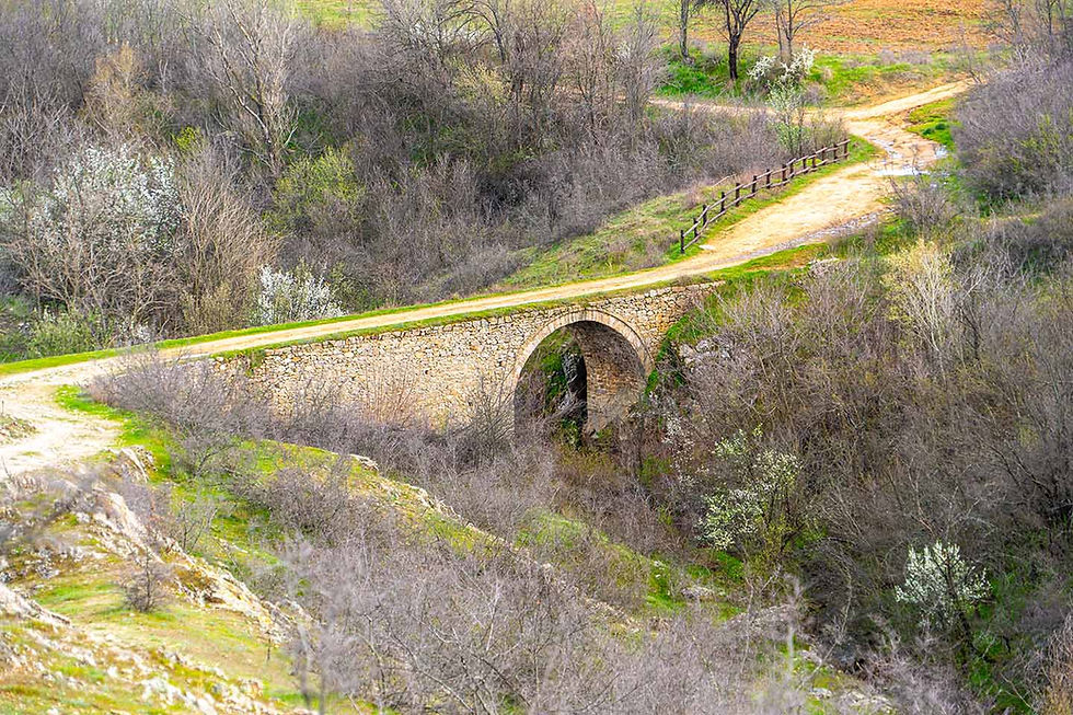
Two bridges over the Asarel and Panova rivers have been newly built along this section.

Near the republican road, where the watershed of the Panova and Asarel rivers is located, in 1928 a commemorative plaque was laid on the occasion of the 50th anniversary of the April Epic.

The text on it reads:
Passenger!
See the two rivers Panova and Asarel merged here under this bridge;
thus merged in the summer of 1876 the souls of our ancestors – there on the Panova River on
OBORISTHE
IN THE FIRST BULGARIAN GREAT NATIONAL ASSEMBLY
for the liberation of Bulgaria.
Take off your hat, even if from afar, and bow before you pass by.
1928
In 1966, on the occasion of the 90th anniversary of the April Epic, a fountain was erected near the memorial plaque, known today as "The Bear's Head".

След това отклонение, което не е част от тази пътека, нека продължим нашата приятна разходка по "Алея на Свободата".

Както сами се убедихме, на места пътеката е доста кална, особено след дъжд, ето защо препоръчваме да бъдете обути с подходящи високи туристически обувки.
Редуват се стръмни участъци, като в най-високата си точка екопътеката достига надморска височина на терена 675 метра над морското равнище.
Гледките оттук са тъй прекрасни!
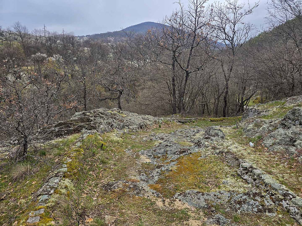
В по-голямата си част положените през 1976 г. оригинални павета са запазени.
Следва спускащ се участък, който ни отвежда до втори мост, новоиздигнат над река Панова.

Следва кратък участък, който все още е незавършен.

Този незавършен и сравнително кратък участък излиза на широк черен път.

Тук пресичате широкия черен път и продължавате по маркирания с павета участък.

Тази част на пътеката е леко стръмна, но тя води до крайната точка на участък II.
След съвсем леко задъхване излизаме на широкия асфалтиран път, водещ в посока Историческа местност Оборище.

Това е крайната точка на участък II – екопътеката от "Алея на Свободата". Точните координати съм посочил върху картата по-долу.
Излизате на широк асфалтиран път, водещ към паркинга, оформен в началото на туристическата пътека, по която се стига до паметника в Историческа местност Оборище.

Този кратък междинен участък е с дължина около 300 метра и се изминава за няколко минути.

Участък III – туристическата пътека до паметника в Историческа местност Оборище


От паркинга до паметника в Историческа местност Оборище води изцяло обновена туристическа пътека.


Почти по цялата дължина са новоизградени обезопасителни дървени парапети.
Самата настилка на пътеката също е нова и всички мостове над река Панова са изцяло новоизградени.
За новата изцяло обновена туристическата пътека разказвам в моята нова публикация, която ще достъпите като натиснете бутона:
Как се стига до град Панагюрище?
Панагюрище отстои на:
94 километра (на около 1 час и 42 минути с автомобил) от столицата
80 километра (на около 1 час и 11 минути с автомобил) от град Пловдив
421 километра (на около 4 часа и 49 минути с автомобил) от град Варна
314 километра (на около 1 часа и 2 минути с автомобил) от град Бургас
Как се стига до началната стартова точка на пътека "Алея на Свободата"?
Началната (стартова) точка на пътека "Алея на Свободата" се намира в най-западната точка на града (самото кръгово кръстовище – крайна западна точка на бул. "Пятигорск").
За всички гости на града, които биха желали да започнат своето приключение именно оттук, ви съветвам да оставите своите автомобили или на паркинга на големия хранителен магазин в близост, или по дължината на околовръстния път, започващ южно от бензиностанцията. За съжаление изграден паркинг в тази зона няма.
И като за финал, мили мои приятели,
не бива да пропускате да разгледате
специалния албум с фото моменти –
открити, изживени, заснети и споделени с вас!


Comments